
Holloways of the Chilterns
/
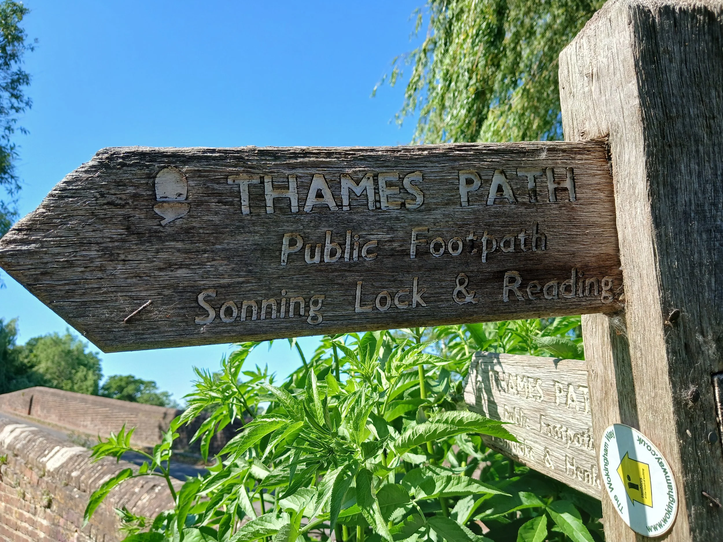
Dames Alice Way
Irresistable and Intriguing
There is something irresistibly intriguing about old paths and byways and none more so than the old sunken lanes or ‘holloways’ which are so characteristic of the soft sand and chalk hills of southern England. These ancient routes are an integral part of our landscape heritage, worn down by the traffic of ages into deep ravines by the passage of countless of feet, hooves and carts and flushed by rainwater over the centuries.
The Chilterns Hills are rich in deep holloways inscribed into the chalk bedrock over centuries and on many of our walks you may become immersed in their cavernous shade and captured in awe by their mystery.
The name holloway is derived from hola weg, meaning sunken road in Old English. Recorded in Anglo Saxon charters, many are at least 1500 years old while some date back to the Iron Age. In some parts of England they may have other names, such as shutes (Dorset) or bostels (Sussex).
Ways of Habit
Holloways are routes of habit, a consequence of repeated journeys, long and short. In the Chilterns they connect the fertile valley, manors and spring-line villages with the more marginal upland areas where the commons and woodlands provided pasture and timber. These ties between the Vale and the Hills remain evident in the historic long and thin pattern of the Chilterns parishes and holloways can often be found marking parish boundaries; an impressive example is the holloway along the boundary of Lewknow and Aston Rowant parishes.
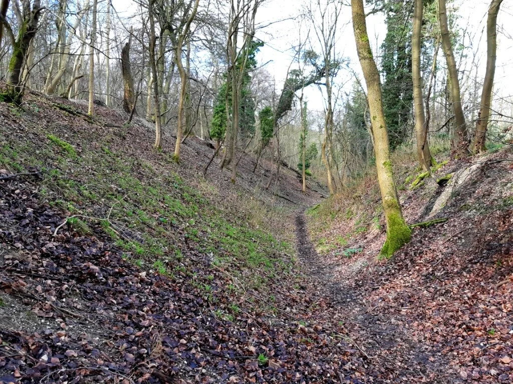
Others would also have been part of longer distance drover routes and packhorse trails across the Chilterns. Some were so heavily used that multiple roughly parallel hollows were formed, as can be seen along the holloway leading up from Dame Alice Farm to Seymour Green, near Watlington.
Parish boundary holloway - Lewknor and Aston Rowant

Mulitple parellel holloways
During the 19th and 20th centuries when roads became properly metalled some holloways became in a sense fossilised; their new metalled surface halting the scarring of time. A striking example is the aptly named Holloway Lane which leads from the picturesque village of Turville up onto the common of Northend. Paths now follow the banks high above the road enabling one to peer down onto passing traffic below.

Holloway Lane, Northend
Other holloways have declined in importance but still remain as rights of way - the tracks and paths we walk today - while some have been long lost to the acts of land enclosures of mediaeval England.

The old coach road to Oxford
The fine holloway which climbs up from Piddington to Studley Green was once part of the old coach road to Oxford (an early route of what is now the A40!).
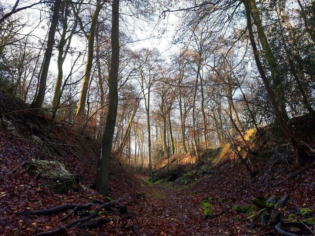
Walk down a holloway today and you will descend into the shadowy depth of a secret world hemmed in by ancient hedgerows and trees with overhanging interlocking canopies like vaulted roofs. Deep and wild with gnarled tree roots growing out of the steep sided walls, their mood alters with the weather and the seasons, ever mysterious, but always delightful!
Wild Places
The essence of the holloway is captured by Gilbert White in his Natural History of Selbourne (1788):
In many places they are reduced sixteen or eighteen feet beneath the level of the fields; and after floods, and in frost, exhibit very grotesque and wild appearances, from tangled roots that are twisted among the strata, and from the torrents rushing down their broken sides... These rugged gloomy scenes affright the ladies when they peep down into them from the paths above, and make timid horsemen shudder while they ride along them; but delight the naturalist with their various botany, and particularly with their curious filices with which they abound.
There is a mystique attached to these sunken ways. Visible remnants of past time, they provide tangible evidence of long forgotten lives and of older ways of travel. Perhaps because of this mystique, Geoffrey Household, in his 1939 novel Rogue Male, has his fugitive hide in a deep holloway in west Dorset.

The Holloway is one of the themes of Robert Macfarlane’s book The Wild Places (2007). In his later a book Holloway, co-written with Dan Richards and so evocatively illustrated by Stanley Donwood (2013), the curious landforms of these dark mystic places are lyrically mused upon in a quest to find Household’s Dorset holloway-hideaway:
…rifts within which time might exist as pure surface, prone to recapitulation and rhyme, weird morphologies, uncanny doublings.
When you walk and travel along them you can’t help but wonder about those who have trod that way before – who were they and why were they making repeated habitual journeys? Were they long distance drovers or local folk fetching water or earning their living from the land? We may find a few clues in the landscape, but… if only those steep fern and moss clad banks could talk!
Routes to the Past
Holloways, along with other historic routeways, are an important part of our Chilterns’ heritage and the Chilterns Conservation Board recently launched the ‘Routes to the Past’ project to record their stories, helping to save them for future generations.
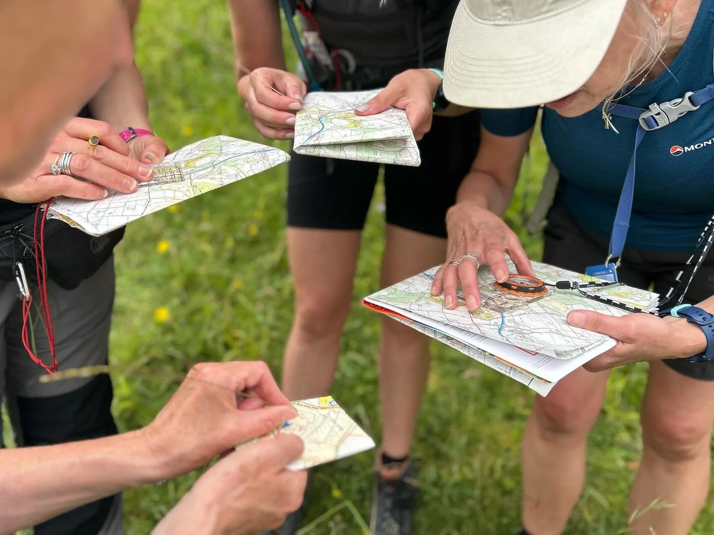
This exciting project is one that we can all get involved in and one Spring afternoon a small band of us set out on foot to explore Dame Alice Way, a fine hollow way near Watlington in Oxfordshire. An account of our exploration awaits a future post!
Find Out More
You can find out more about Routes to the Past and how to get involved HERE.
All photographs in this article were taken by, and remain the copyright of, the author.